Route of the Flowers
DISCOVER ITS HISTORY AND TRADITIONS
The Route of the Flowers is filled with a lot of history, with the participation of characters and institutions that have taken relevant actions to achieve recognition of the population of El Salvador, and the influx of international tourism.
In the west of the country there are mountains and important elevations above sea level, among them the Cordillera Apaneca-Ilamatepec, which highest part reaches 2,381 meters. In a good portion of these elevations there are six municipalities: Ahuachapán, Concepción de Ataco, Apaneca, Juayúa, Salcoatitán and Nahuizalco, which are connected by a road called “The Route of the Flowers.”
A Tourist Route is the integration of different tourist areas through the management of tourist routes with the interpretation of elements such as productive activities, scenic attractions or other attractions that allow to offer a quality experience through the creative management of existing resources (natural areas, crafts, special attractions, traditions, and gastronomy, among others).
Municipalities that make up the Route of the Flowers:
Ahuachapán
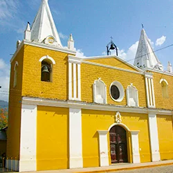
The Department of Ahuachapán is the westernmost of the 14 departments in which the Republic of El Salvador is divided. Its provincial capital, the city of Ahuachapán, is located 100 kilometers from the Salvadoran capital. Its Nahuatl name means “city of the house of the oaks”, with an eminently coffee producing population. Among its tourist attractions are the Church of Our Lady of the Assumption, in the historic center of the city; La Concordia passage, on the side of the church; the Alfredo Espino Culture and Arts Center, a young poet who wrote poetry alluding to prints, customs, facts and in essence nature, crops, trees, and birds that are characteristic of the area. Another tourist attraction are the Ausoles, emanations of steam that arise from the entrails of the earth, geothermal manifestations. The Ahuachapán and Berlin Ausoles, in the east of the country, generate 23% of the energy demanded by El Salvador. El Imposible Forest National Reserve, a large forest with ecological interest, is also located in Ahuachapán.
Concepción de Ataco
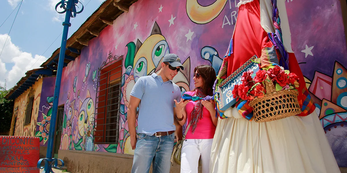
Towards the mountain range, starting from Ahuachapán, and on the road leading to Sonsonate, at 1,260 meters above sea level is Concepción de Ataco, which name of Nahuatl origin means “place of high springs.” Over the years, this population has worked on lever looms, and has carved wooden crafts. Surrounded by coffee plantations, gourmet and traditional local cuisine are options for tourists. The Day of the Farolitos is a tradition that has remained alive for more than 200 years, and is celebrated since then, filling all the streets of the town with light with colored lanterns.
Apaneca
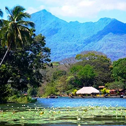
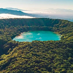
Apaneca is the city of Route of the Flowers with greater height above the sea level, with 1,470 meters. Its Nahuatl name means “where gusts of winds/rivers abound”. Due to its altitude, the area produces coffee of the highest quality. The hotels and restaurants combined with its two lagoons “Las Ninfas”, and “Laguna Verde” attract tourists to this pre-Hispanic city where the sculptures known as “Gordinflones” are located on coffee plantations. The practice of adventure sports such as buggies and canopy, as well as ecotourism such as landscaping and hiking, can be practiced in Apaneca.
Juayúa
Juayúa is a pre-Columbian town which Nahuatl name means “river of purple orchids”. The city is located 1,025 meters above sea level. Its nurseries of ornamental plants, its coffee crops and gastronomy are peculiar tourist features of this city, where every weekend, since 1997, a gastronomic fair is organized in the center of the city. Additionally, Juayúa offers places to practice ecotourism such as the Monterrey River, Lagunilla Azul Waterfalls, Los Chorros de la Calera, El Tequezal, La Laguna Seca or Las Ranas, Laguna Verde, Cerro El Aguila and El Pilón, true spectacles that should not be missed.
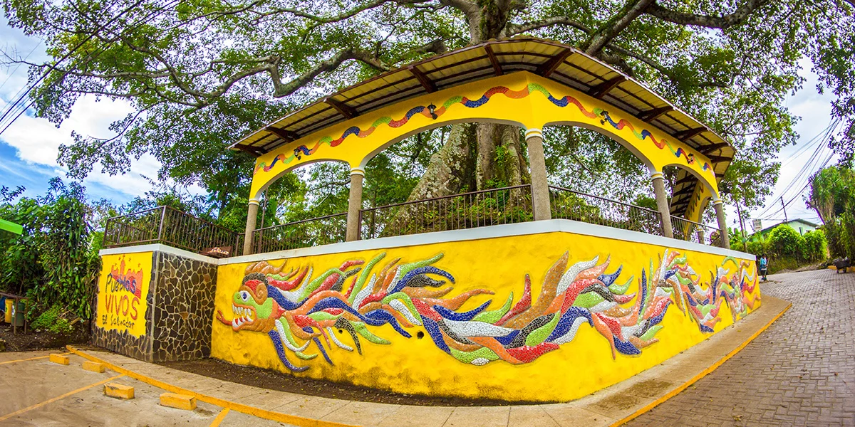
Salcoatitán
Its name of Nahuatl origin means “place between snakes and quetzals”, and is located 1,045 meters above sea level. Among its main tourist attractions are its traditional cuisine, which is offered in the town square; the craftsmanship and the method used for the elaboration of mosaic murals; and, regional art galleries where you will find objects made of wicker, fabrics, manta and indigo-dyed blankets, natural dyes, and pieces of art and culture, to decorate your home.
Nahuizalco
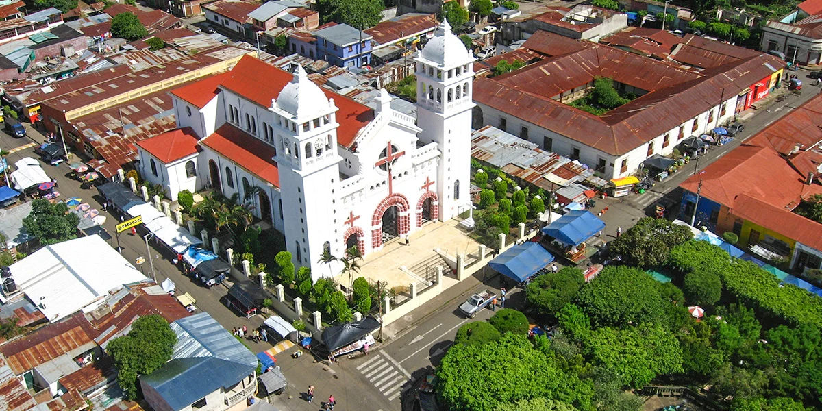
Nahuizalco is a town of pre-Hispanic origin, which Nahuatl name means “four Izalcos”. It was originally inhabited by Pipiles, and in colonial times the region belonged to the Province of the Izalcos. Nahuizalco is a city since 1955, with an exceptional arrangement in its central square and its markets, including the night market, exclusive to that municipality. It has a wealth of crafts, highlighted by the production of handicrafts made with wicker and tule, as well as the production of items such as hats, mats, sausages and wood furniture and crafts. The Pipil Memorial Museum is a cultural landmark that is recommended to tourists in general to learn about the indigenous settlements. Nahuizalco is one of the last places where a few people still speak the Pipil language (Nahuatl). The visits to the Church of San Juan Bautista, built in the eighteenth century, as well as the waterfalls and the Craft Development Center, which can be visited to learn about the production processes for the manufacture of crafts of different nature, are highly recommended.
GEOPOSITION
OTROS LUGARES DE INTERÉS QUE TE PUEDEN INTERESAR

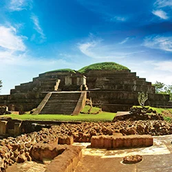
Gladden Spit and Silk Cays Marine Reserve
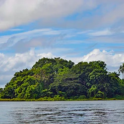
Solentiname
Trujillo
OTRAS FORMAS DE VIVIR CENTROAMÉRICA
TOURS RECOMENDADOS
Mayans and Surf City
The history and mysticism of Guatemala, Honduras, El Salvador, and Nicaragua in this tour loaded with culture and nature in Central America.
Guatemala – Nicaragua – El Salvador: Charco Verde & Petroglyphs
Travel through volcanoes, Mayan archaeological sites, colonial cities and natural parks in this Central American multi-destination tour.
Trilogy of the Central Caribbean
Enjoy adventure and nature with this colorful program.
Costa Rica – Nicaragua: Forests, Volcanoes and Colonial Cities
Hike through the forest, fly through the trees, visit impressive colonial cities, and admire active volcanoes...feel a thousand sensations
Route of the volcanoes: Maya, lencas and garífunas
Discover volcanoes, colonial cities, pre-Columbian archaeological sites, and nature, and meet with the indigenous communities.